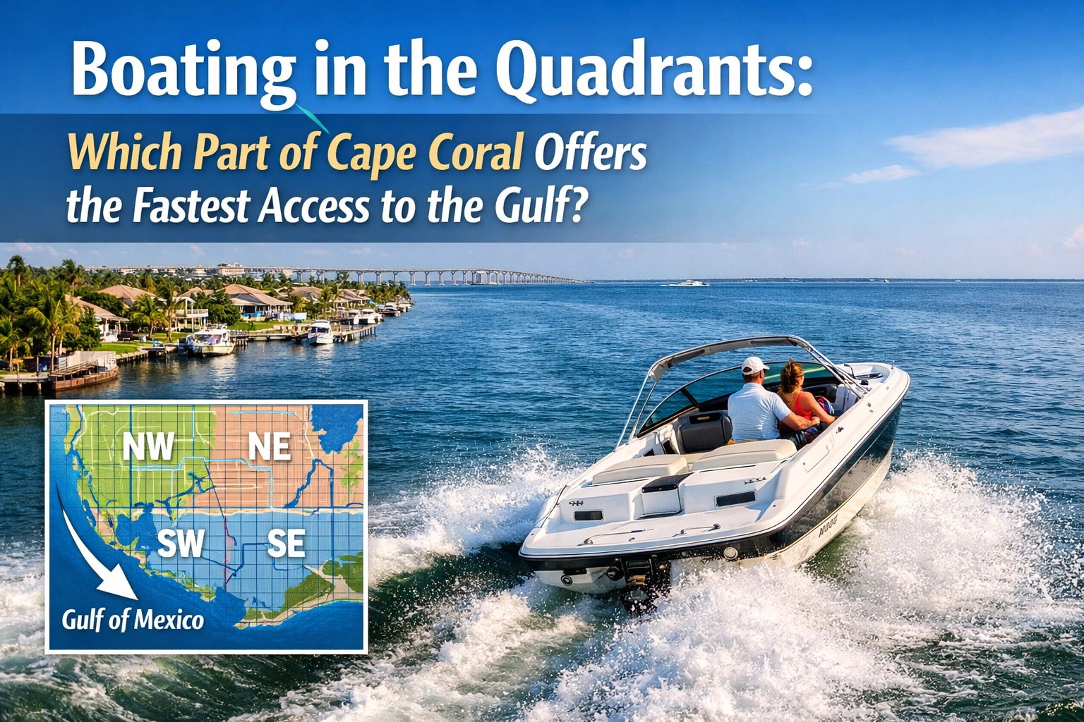
If you're house-hunting in Cape Coral and you've got a boat in the equation, you're probably asking the big question: Which quadrant gets me to the Gulf the fastest?
It's not just about having waterfront access. It's about whether your Sunday morning fishing trip starts at sunrise or noon after you've spent two hours navigating canals and waiting at boat locks. Let's break down which Cape Coral quadrants offer the fastest routes to open water, and what factors actually matter when you're trying to shave time off your commute to the Gulf.
Why Gulf Access Time Actually Matters
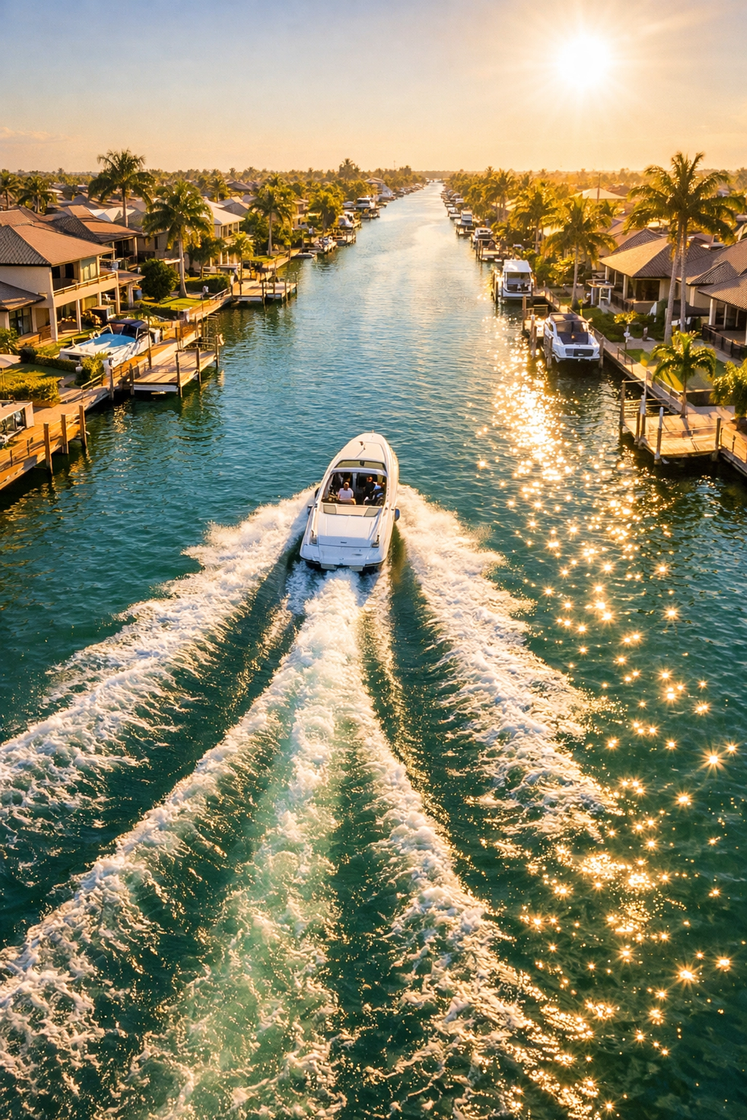
Before we dive into the quadrants, let's talk about why this even matters. If you're buying a waterfront home in Cape Coral, you're probably picturing quick weekend getaways to Sanibel, island hopping around Pine Island Sound, or fishing offshore. The difference between a 15-minute trip and a 60-minute slog can literally change how often you use your boat.
And in SWFL, where time on the water is half the reason people move here in the first place, that matters. It affects property values, resale appeal, and your actual quality of life. So yeah, it's worth understanding before you make an offer.
The Winner: Northwest Cape Coral
Let's cut to the chase. If speed to the Gulf is your priority, Northwest Cape Coral is your best bet. Here's why:
Homes in the northwest section have the most direct route to open water via the Matlacha Pass Bridge on Pine Island Road. This route bypasses the majority of Cape Coral's internal canal maze and gets you straight into Pine Island Sound. From there, you have quick access to the Gulf, Sanibel, Captiva, and Boca Grande.
For boaters in the northwest quadrant, you're typically looking at 20 to 40 minutes from your dock to the Gulf, depending on your exact location within the quadrant. That's about as good as it gets in Cape Coral.
The key advantage? You're avoiding the Caloosahatchee River route (which adds significant distance) and you're not dealing with the Cape Harbor boat lock (more on that nightmare in a second).
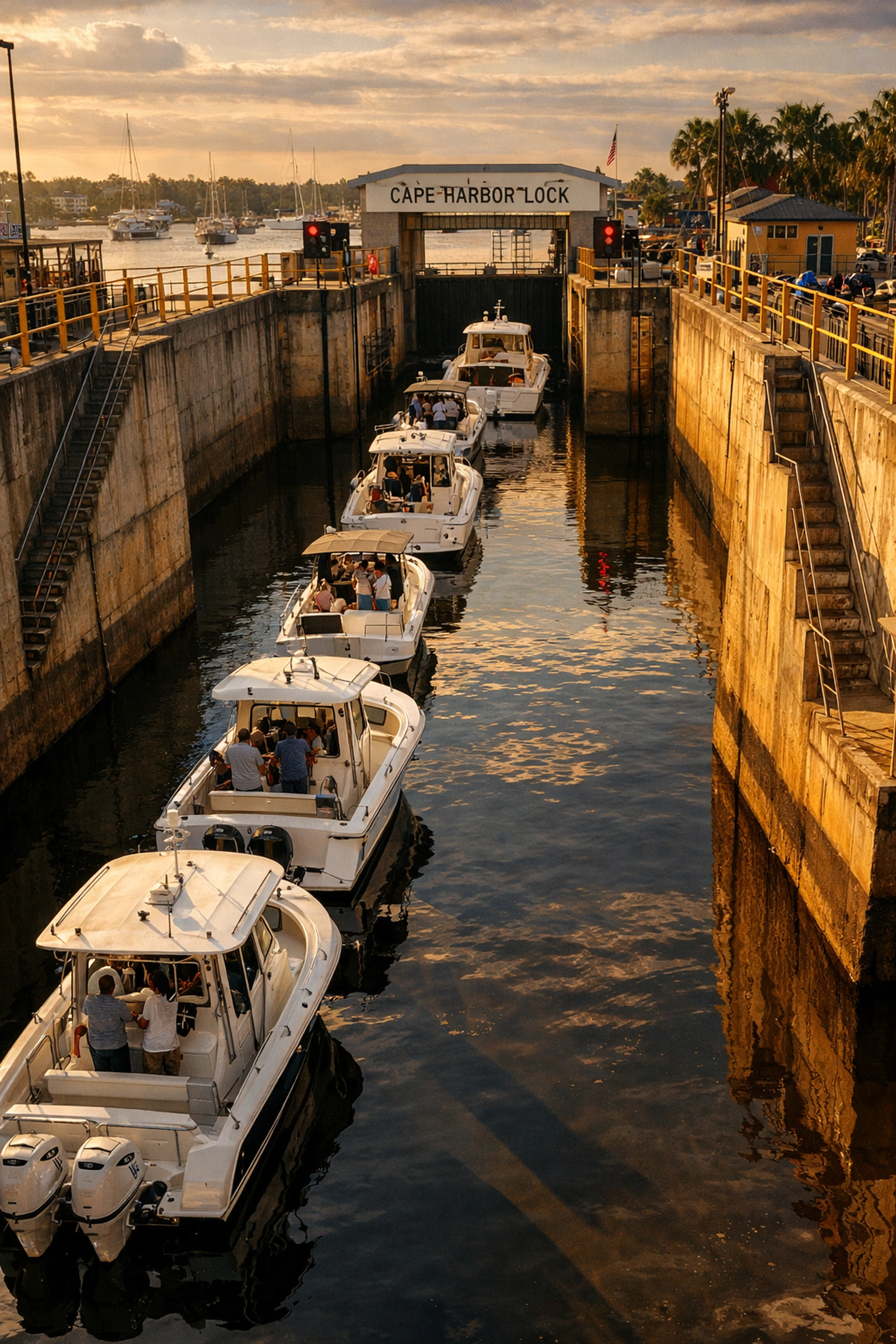
The Challenge: Southwest Cape Coral
Now let's talk about the southwest quadrant, which includes some of the most desirable Cape Coral waterfront homes, especially around Cape Harbor and the southern canals west of Chiquita Boulevard.
Here's the problem: If your home is south of Cape Coral Parkway and west of Chiquita Boulevard, you're likely dealing with the Cape Harbor boat lock.
The boat lock is a necessary piece of infrastructure that controls water levels, but it's also a massive time-killer. On a busy weekend, you could easily wait 30 to 45 minutes just to pass through. Even on a quiet weekday, expect to add at least 15 to 20 minutes.
Once you're through the lock, you still have to navigate south through the canals to reach the Caloosahatchee River, then head west toward San Carlos Bay and eventually the Gulf. All told, you're looking at 60 to 90 minutes or more from dock to Gulf, sometimes longer during peak season or bad weather.
That said, the southwest quadrant has its perks. You're closer to Fort Myers Beach, the canals are often wider and deeper, and the neighborhoods tend to be newer with better infrastructure. But if speed is the goal, this isn't your quadrant.
Northeast and Southeast: The Middle Ground
The northeast and southeast quadrants fall somewhere in between. Your travel time depends heavily on how close you are to the Caloosahatchee River and which direction you're headed.
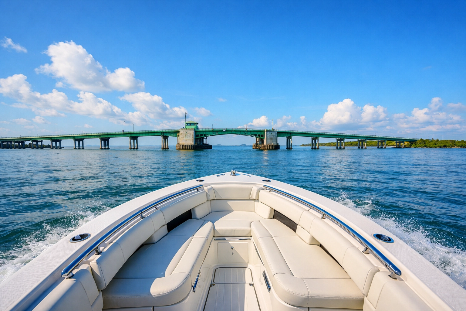
Northeast Cape Coral properties that back up to the Caloosahatchee have relatively quick access to the river itself, which is a major artery. From there, you can head west toward the Gulf (via San Carlos Bay) or east toward Fort Myers and beyond. Expect 40 to 60 minutes to reach the Gulf, depending on your exact location and how far east you are in the quadrant.
Southeast Cape Coral is trickier. Some homes have direct Caloosahatchee access, which is great. But others are deeper in the canal system and require longer navigation through no-wake zones before hitting the river. You're typically looking at 50 to 75 minutes to the Gulf from most southeast locations.
The wildcard in both quadrants is bridge clearance. If you have a boat with a tall tower or a sailboat, you'll need to factor in whether the bridges along your route can accommodate your vessel. The Cape Coral Bridge and Midpoint Bridge both have decent clearance, but some internal canal bridges do not.
What Really Affects Your Travel Time
Okay, so quadrant matters. But it's not the only thing that determines how fast you get to the Gulf. Here are the other variables:
No-Wake Zones
Most of Cape Coral's saltwater canals are designated as no-wake zones, which means you're limited to 5 mph until you reach open water. This is for safety and to prevent erosion, but it also means that the primary factor in your travel time is simply distance.
If you're five miles from the canal mouth in a no-wake zone, that's a full hour at 5 mph. There's no shortcut.
Bridge Clearances
If your boat has a tall tower, T-top, or any kind of elevated structure, you need to know the clearance heights of the bridges along your route. Some Cape Coral bridges have 20+ feet of clearance at high tide, but others don't. Check the city's canal maps before you buy.
Water Depth and Canal Conditions
Not all canals are created equal. Some are deep and well-maintained. Others are shallow, full of sandbars, or plagued by low tide issues. If you have a larger boat with a deeper draft, you'll need to pay close attention to the depth charts for your specific canal.
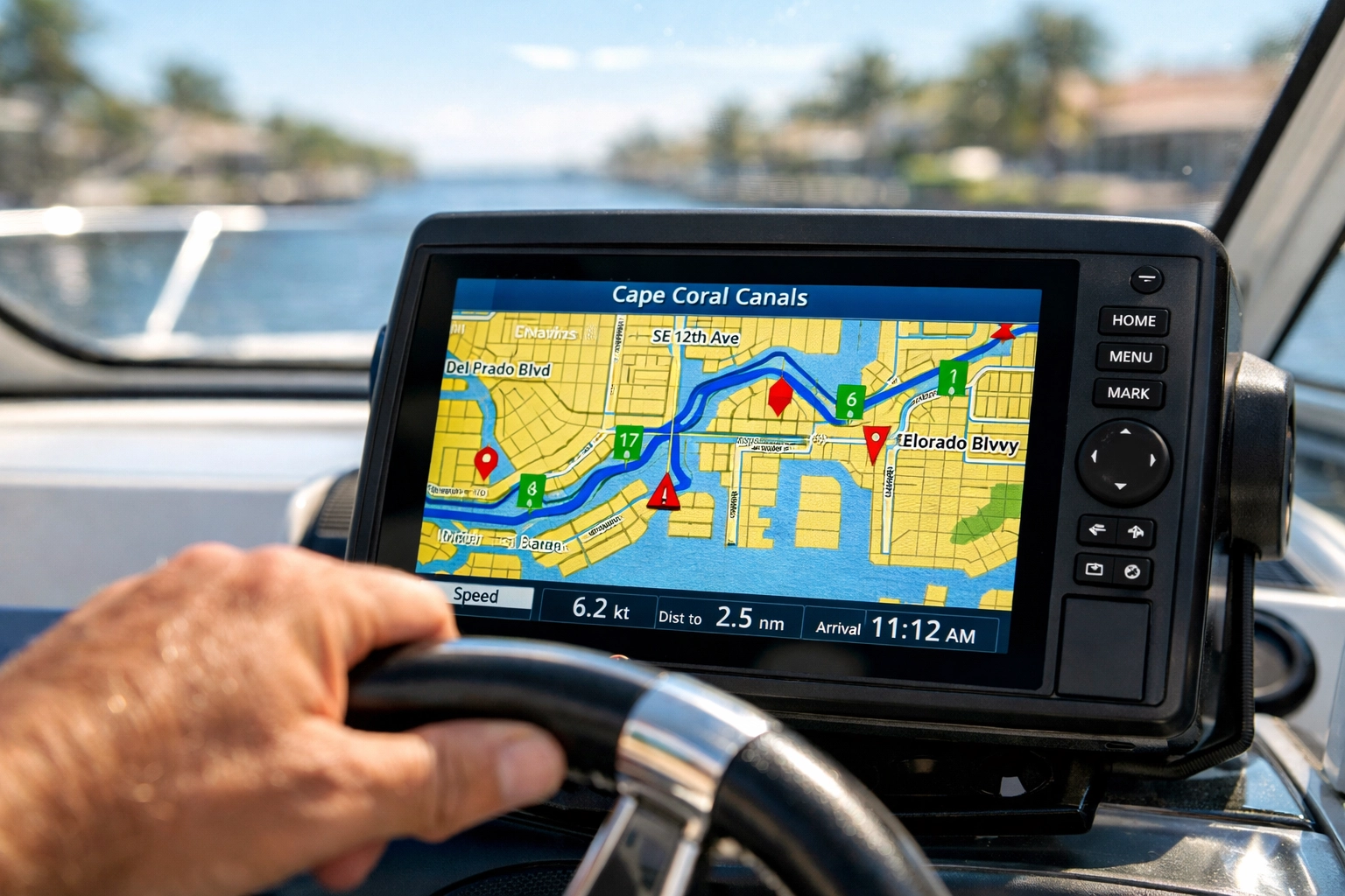
Cape Coral provides an interactive boating calculator and detailed canal maps that show bridge heights and approximate exit times for different areas. It's worth spending an hour with these tools before you make an offer on a waterfront home.
Current and Weather
Southwest Florida tides and currents can work for you or against you. A strong outgoing tide can shave time off your trip to the Gulf, while an incoming tide can slow you down. Wind and chop also play a role, especially in the more exposed areas near the passes.
How to Calculate Your Specific Travel Time
Want to get precise? Here's the formula:
- Measure the distance from your potential dock to the canal mouth (use Google Earth or the city's canal maps).
- Add the distance from the canal mouth to your target pass (Matlacha Pass, San Carlos Bay, or wherever you're headed).
- Divide by 5 mph for all no-wake zones (which is most of the Cape Coral canal system).
- Add time for any boat locks, bridge openings, or known choke points.
- Factor in your boat's cruising speed once you hit open water.
For example: If you're 3 miles from the canal mouth (that's 36 minutes at 5 mph) and another 2 miles to open water (24 minutes), you're looking at a baseline of 60 minutes before you even account for locks or delays.
The city's interactive tools can help automate some of this math, but it's smart to do a test run before you buy. Seriously: rent a boat, launch from the nearest public ramp, and time the route yourself.
The Bottom Line: Location, Location, Location
If Gulf access speed is a top priority, northwest Cape Coral is your best bet. You get the shortest route, the fewest obstacles, and the most direct access to Pine Island Sound and the Gulf.
If you're willing to trade some travel time for other amenities: like proximity to Fort Myers Beach, newer neighborhoods, or specific canal features: then the southwest, northeast, or southeast quadrants can still work. Just know what you're signing up for.
And if you're serious about boating, don't skip the due diligence. Check the canal maps, measure your route, factor in no-wake zones, and test the commute before you close. Your future self will thank you when you're out on the water every weekend instead of stuck idling through canals.
Want to dive deeper into Cape Coral quadrants and waterfront homes? We've got you covered. Reach out to our team and we'll help you find the perfect spot that gets you from dock to Gulf in record time.
Key Takeaways
- Northwest Cape Coral offers the fastest Gulf access (20-40 minutes) via Matlacha Pass.
- Southwest Cape Coral deals with the Cape Harbor boat lock, adding 60-90+ minutes to your trip.
- Northeast and Southeast quadrants fall in the middle (40-75 minutes), depending on Caloosahatchee access.
- No-wake zones, bridge clearances, and water depth all affect travel time.
- Use the city's canal maps and boating calculator to estimate your specific route before buying.